Bangalore Bengaluru International Airport (BLR)
Orientation and Maps
(Bangalore, India)
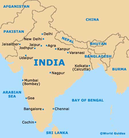
Located in the province of Karnataka, Bangalore is the state capital and has become the third-biggest city in the whole of the country. Known for its industrial and technological past, the city of Bangalore is located towards to southern tip of India and is often also referred to as 'Bengaluru'. Bangalore lies on the elevated Mysore Plateau and is home to a number of large lakes, of which Sankey, Ulsoor and Yediyur are especially prominent.
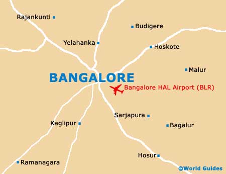
Each year more than eight million passengers fly into Bangalore HAL International Airport (BLR), on the south-eastern side of the city. India's number four airport, Bangalore Airport dates back to 1964 and commercial flights here only began in the early 1980s.
Bangalore HAL International Airport (BLR) Maps: Important City Districts
Often referred to as the 'Garden City of India' due to its climate and number public parklands, the city of Bangalore is extremely tourist-friendly and visitors are always made to feel welcome. Home to the noteworthy Kannada film industry, the city features a number of exciting annual events, such as the Festival of Lights (Deepavali), an important Hindu festival held towards the end of October.
The main districts in the city include central Bangalore, Hoskote to the east, Devanhalli and Dod Ballapur to the north, Nelamangala to the north-west, and Magadi to the west. On the southern side of the city are the neighbourhoods of Anekal, Channapatna, Kanakapura and Ramanagaram. Surrounding Bangalore are the suburbs districts of Kolar, Tamilnadu, Mandya and Tumkur.
India Map
Bangalore Map